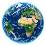
The day/night boundary follows the Sun’s current position, even when rotation is paused. Night lights: NASA’s 2016 composite. Clouds are illustrative imagery.
SOURCES
Good questions. Real sources.
Each number is tied to an independently published source and a reference period. Open a measure to see its definition and provenance.
The planet behind the data
Earth surface and clouds by Solar System Scope, licensed CC BY 4.0. Night lights use NASA’s 2016 Black Marble, by NASA Earth Observatory / Joshua Stevens, using Suomi NPP VIIRS data from Miguel Román, NASA GSFC. The grayscale composite is resized and given a warm tint for this view. Regional zoom loads more detailed night imagery and daytime tiles from NASA GIBS Blue Marble Next Generation. These are historical composites, not live satellite images. Country boundaries use Natural Earth public-domain geometry. Flags use the MIT-licensed flag-icons package. Cloud and city-light textures are illustrative composites, not current satellite observations.
Loading Earth
— UTC
NS
Drag to explore · scroll to zoom
MEANWHILE OUR SHARED PERSPECTIVEPopulation · 2025 · World Bank
LOOK A LITTLE CLOSER
A planet of possibilities.
Follow your curiosity. Explore the numbers behind our world.